West Coast Ports Could Suffer from Alaska Tsunami
- John Cornelison
- September 5, 2013
Table of Contents
 |
Maximum current speeds for the Port of Los Angeles (POLA) and the Port of Long Beach (POLB), according to the SAFRR Tsunami Scenario. In the POLA, currents are strongest at Angels Gate, the Cabrillo Marina, the Boat Yard, and the old Navy Yard. Once the tsunami event is underway, navigation through the Gate would be very dangerous. In the Cabrillo Marina and Boat Yard, currents are likely strong enough to break apart floating docks, damage piles, and pull small vessels from their mooring lines. The strongest currents are found in the old Navy Yard; however there are no exposed floating assets in this immediate area. At the POLB, again strong currents are found at the Gate. Also in the POLB, strong and jet-like currents are predicted at the entrance to the main cargo container area (Pier J). Currents here may be strong enough to damage, and possible break, mooring lines. Photo Credit: SAFRR Tsunami Scenario. (Larger image) |
A hypothetical yet plausible scenario was developed where a tsunami is created by an earthquake offshore from the Alaskan peninsula and extends to the California coast. This is detailed in a new report titled, the U.S. Geological Survey's Science Application for Risk Reduction (SAFRR) Tsunami Scenario.
While the report analyzed damage to California exclusively, the entire West Coast would face impact as shown by Figure 1, depicting predicted maximum wave heights.
 Some of the issues highlighted in the scenario include public safety and economic loss. In this scenario approximately 750,000 people would need to be evacuated, with 90,000 of those being tourists and visitors. Additionally, one-third of the boats in California's marinas could be damaged or completely sunk, resulting in $700 million in losses. It was concluded that neither of California's nuclear power plants would likely be damaged by this particular event.
 Looking back to 2011, not only was Japan devastated by the magnitude 9.1 Tohoku earthquake, but the resulting tsunami also swept through California and caused $50-100 million of damage. This shows that tsunamis near and far can lead to billions of dollars in losses in California.
The SAFRR Tsunami Scenario is a collaborative effort between the USGS, the California Geological Survey, the California Governor's Office of Emergency Services, the National Oceanic and Atmospheric Administration, other agencies, and academic and other institutions.
This scenario will also be the focus of discussion at a workshop series starting September 4 that is convened in partnership with the California Tsunami Hazard Mitigation Program. USGS scientists and partners will explain the scenario and results to stakeholders in the coastal communities of California. The workshops aims to establish a community of experts while fostering the use of science in decision-making.
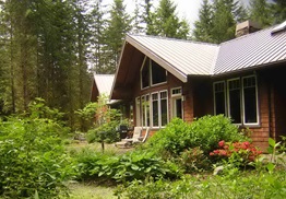 Even in temperate western Washington it can take only a few sunny days for forests to dry out enough to catch fire. And, in windy conditions wildfires can get out of control quickly. Wildfires burn every year in east King County. Before wildfire strikes, homeowners can help protect lives and property by creating a fire-adapted space around structures.